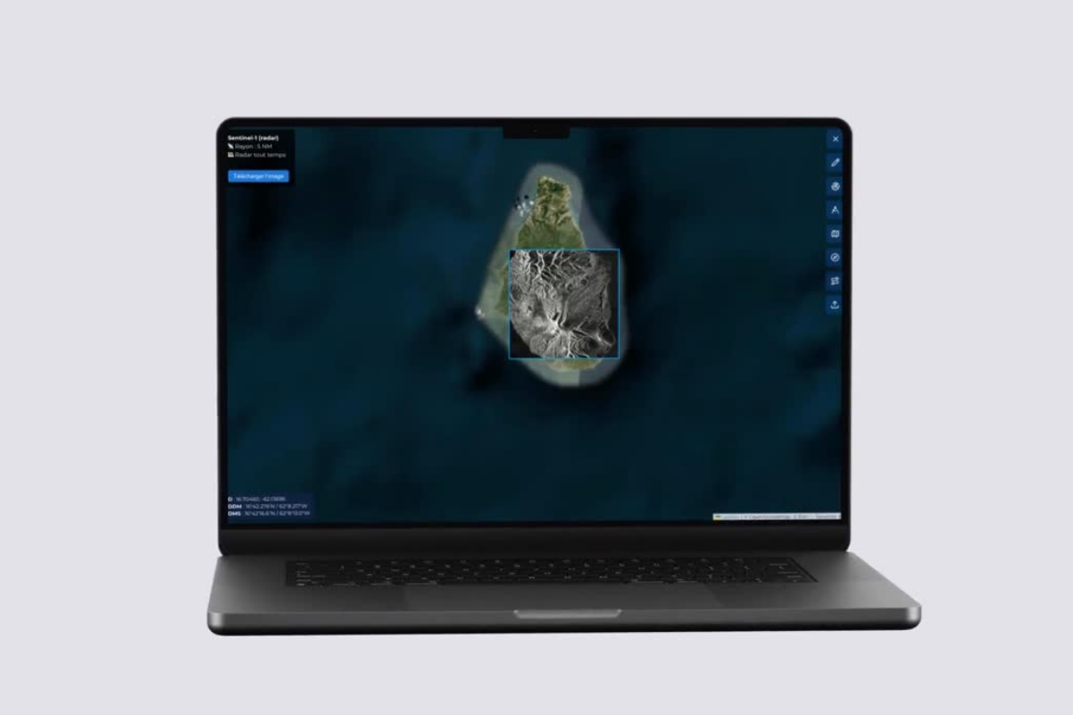
Did you know that SARCHAT can now retrieve the latest Copernicus satellite imagery — Sentinel-1 and Sentinel-2 — in just a few seconds, directly within your operational interface?
This new integration connects SARCHAT to Europe’s most advanced Earth Observation infrastructure, operated by European Space Agency - ESA and EUSPA - EU Agency for the Space Programme .
• Sentinel-1 provides all-weather, day-and-night radar (SAR) imagery. For Search and Rescue, this is critical: SAR images can reveal vessel signatures, assess sea state, identify slicks, debris or anomalies, even through clouds, storms or darkness.
• Sentinel-2 delivers high-resolution multispectral optical imagery. In a SAR context, it supports coastline monitoring, detection of burned or disturbed areas, analysis of drift corridors, identification of coastal anomalies and rapid assessment of zones affected by natural events.
Integrating these datasets into SARCHAT significantly enhances situational awareness, particularly in remote areas, during major emergencies or throughout active search-and-rescue operations.
This capability fits naturally within SARCHAT’s mission: restoring structure, clarity and security to information flows during multi-agency operations and crisis situations.
Will you be able to recognise the island?
If your agency or organisation would like to learn more, we offer complete presentations and in-depth demonstrations of SARCHAT and its capabilities.
SARCHAT can now retrieve the latest Copernicus satellite imagery